Geo-fenced Speed Limiting: How It Works and Where It Fits
Jul 5, 2025 Resolute Dynamics
Ever seen a delivery truck breeze through a school zone like it’s chasing a finish line? That’s not just risky—it’s avoidable. Enter geo-fenced speed limiting, a tech solution that doesn’t just talk about road safety but actually enforces it.
Fleet managers are tired of nagging drivers to follow speed limits. Cities are tired of accidents. Geo-fencing offers a way to cut through the noise and let machines do the heavy lifting.
✅ Key Takeaway
Geo-fenced speed limiting helps vehicles slow down automatically when they enter certain zones—like school areas, city streets, or work zones.
It uses GPS, vehicle controls, and smart rules to cap speed without relying on the driver to react. Think of it like cruise control with a local brain.
It kicks in right where it should, without warnings or delays. Fleets in the UAE, India, and Europe are already using it to reduce fines, lower accident risks, and follow local road rules—all without extra pressure on drivers. It’s clear, quick, and built for everyday use.
What is Geofencing and How Does It Work?
Think of geo-fencing like drawing an invisible electric fence on a map. When a vehicle crosses into that digital boundary, rules kick in. It might be speed limits, no-idle zones, or alert triggers.
Most systems use GPS data and digital maps to draw these fences. Some are simple circles around a point—like a hospital or school—others use polygons to match the shape of real-world areas, like a construction site or downtown grid.
Once set up, geo-fences talk to the vehicle’s control unit. If a truck enters a low-speed zone, it doesn’t just suggest slowing down—it can throttle the engine or issue alerts instantly.
How Geo-fenced Speed Limiting Operates

Let’s walk through what really happens under the hood when a vehicle enters a geo-fenced zone. It’s not just GPS tapping the driver on the shoulder. It’s a synchronized play between software, hardware, and data channels—all reacting in milliseconds.
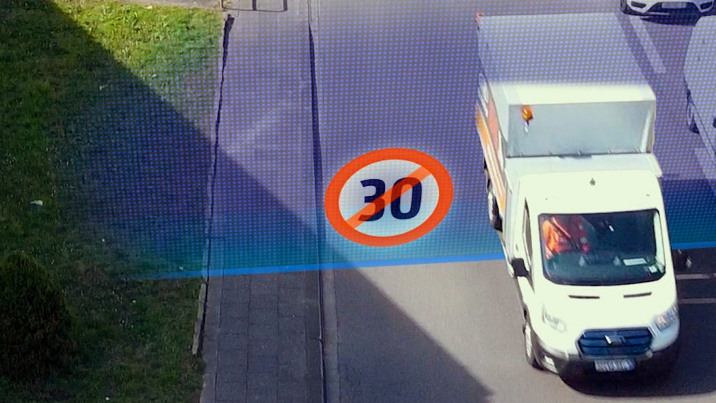
A Real-World Example: The Truck in the 40 km/h Zone
Imagine this. A logistics truck is hauling packages through the outskirts of Jaipur. It approaches a city boundary where the speed limit suddenly drops from 70 to 40 km/h. No traffic cop in sight, no signs flashing warnings. But the truck slows down anyway. Automatically.
Here’s how it happens:
1. Geo-fence Detection via GNSS
The truck’s on-board GNSS receiver (a high-precision cousin of standard GPS) constantly tracks location down to a few centimeters. It detects the vehicle has crossed into a digital speed-limited zone set on a cloud-based mapping service. No manual input. No delays.
2. Rule Engine Triggers in the Telematics Control Unit (TCU)
Once inside the zone, the TCU gets the signal. Think of it as the brain in the vehicle’s safety system. The TCU cross-references the vehicle’s current speed against local geo-fence rules stored on board or synced from the cloud.
3. Speed Management via ECU and Digital Governors
If the truck’s moving faster than allowed, the TCU talks to the Engine Control Unit (ECU). That’s where commands get real. The ECU adjusts the engine’s output—either by throttling fuel injection, limiting RPMs, or activating the digital speed governor.
4. Driver Feedback via HMI Alerts
Meanwhile, the Human-Machine Interface (HMI) displays a message on the dashboard. Maybe it beeps, flashes a warning, or displays “Speed Limited to 40 km/h.” The driver knows exactly what’s going on, but the system isn’t asking for permission—it’s already in control.
5. Fleet Data Sync and Analytics
Back at the fleet manager’s office, the entire event gets logged in real time. Through cellular or V2X communication, the data uploads to a central dashboard. Managers can see exactly when and where speed limits were enforced. They can even analyze driver responses and compliance patterns.
No Loopholes. No Guesswork.
What makes this powerful is that there’s no reliance on human decision-making in critical moments. The vehicle doesn’t “ask” to slow down. It does. Immediately. Silently. Consistently.
And because the tech stack is modular, this setup can work in delivery vans, school buses, or cross-border transport trucks. One rule set can serve dozens of vehicle types—whether the operator is in Riyadh or Rotterdam.
Benefits for Automotive Safety and Compliance
Here’s what matters: fewer accidents and more compliance without needing drivers to remember a thousand rules.
- Zero ambiguity: Drivers can’t ignore what they don’t control.
- Smart enforcement: Speed policies are enforced exactly where needed—school zones, steep curves, or tunnels.
- Insurance leverage: Data logs offer evidence in case of claims or audits.
- Fleet efficiency: Managers stop worrying about citations or unsafe practices.
And it’s not just theory. Regions like the EU and parts of the Middle East are already leaning hard into speed control via digital boundaries.
Integration with Resolute Dynamics’ Platform
Let’s get practical. Fleet operators don’t want disconnected tools and a stack of dashboards that don’t talk to each other. They want something that plays well with what they’ve already got. That’s exactly where Resolute Dynamics stands out.
This isn’t just a speed control add-on. It’s part of a modular, AI-driven safety ecosystem built for real-world fleet operations—whether you’re running 50 vans across Abu Dhabi or managing a thousand rigs across Southeast Asia.
Modular Architecture with Connected Intelligence
At the core, the platform merges multiple safety and analytics layers:
- Vision Systems
These aren’t just dashcams. They analyze road signs, traffic density, lane markings, and pedestrian movement in real time. It’s like giving the vehicle a second set of eyes—ones that never blink. - AI-Powered Behavior Models
Every vehicle learns from patterns. Speeding in wet conditions, aggressive lane changes near construction zones—these aren’t just red flags; they’re predictors. The platform’s machine learning models are trained on millions of data points to anticipate risk before it happens. - Dynamic Geo-Fencing Engine
Zones aren’t static. They can adjust based on time of day, road conditions, or temporary hazards. The platform supports dynamic updates pushed over-the-air, so speed restrictions can shift based on real-time context. - Fleet Command Dashboard
A cloud-based control center where operators can monitor zone breaches, review enforcement logs, or update policy templates. It’s intuitive, visual, and built with enterprise-scale fleets in mind.
Seamless Telematics Integration
The platform doesn’t operate in a silo. It integrates directly with standard vehicle telematics systems, pulling in and pushing out data via CAN bus or OBD-II. Whether you’re already using Geotab, Samsara, or a homegrown fleet tracker, Resolute’s API framework keeps everything flowing smoothly.
Beyond Speed: Holistic Safety Intelligence
Speed is just one layer. The platform also delivers:
- Driver Behavior Analytics: Track harsh braking, idle time, lane weaving, and real-world fatigue indicators.
- Predictive Maintenance Insights: Use sensor data and trip logs to flag potential failures before they happen—reducing downtime.
- Regulatory Compliance Monitoring: Set rule templates by region to align with local regulations, whether in the EU, UAE, or Southeast Asia.
Adaptable to Any Fleet Type or Geography
Here’s what makes it scale: The same system works across refrigerated trucks, passenger shuttles, and mining vehicles. And it’s fully deployable in low-connectivity regions using edge processing on local telematics units.
Whether you’re managing congested delivery routes in Mumbai or highway freight runs in Riyadh, the geo-fenced enforcement logic adapts in real-time to context, risk, and regulation.
Built for Action, Not Just Data
Some platforms give you a wall of charts. This one takes action. Vehicles slow down automatically. Drivers get real-time HMI alerts. Fleet managers receive mobile notifications the moment policies are violated.
In short: the system doesn’t just flag issues. It fixes them in motion.
Real-world Applications
Geo-fenced speed limiting isn’t stuck in a prototype lab or waiting on future infrastructure. It’s already being used—in cities, in fleets, and on actual roads where speed can mean the difference between a close call and a crash.
Let’s take the concept out of the abstract and show how it’s working in the real world.
Urban Zones: Cutting Speeding Violations by 30%
In high-density urban areas like Dubai, Bengaluru, and Kuala Lumpur, local authorities have begun geo-fencing critical zones—school vicinities, hospital perimeters, and no-honking corridors.
One pilot program in Sharjah saw a 30% drop in speeding violations within geo-fenced safety zones after just four months of deployment. Drivers didn’t have to guess the limit; their vehicle told them—or better yet, controlled the limit for them.
Fleet Use Case: Logistics Operator in Abu Dhabi
Consider a delivery company operating 200 refrigerated trucks across Abu Dhabi and Al Ain. The company struggled with repeated fines for overspeeding, especially when vehicles entered residential zones during late-night runs.
After deploying a geo-fenced speed limiting solution integrated with their existing fleet telematics, violations dropped by over 40% in six months. Even better, insurance premiums fell as they demonstrated consistent compliance using real-time logs.
School Zones with Time-Based Rules
Geo-fencing really shines in environments that change depending on the time of day. School zones are a prime example. In Riyadh, several school districts now use time-triggered geo-fences—lowering speed from 50 km/h to 30 km/h between 7:30–8:30 AM and again at dismissal time.
The result? Speeding in front of schools during those hours has become nearly nonexistent, with 98% compliance rates logged across all vehicles equipped with the system.
Construction Sites and Temporary Work Zones
Construction zones are notorious for being inconsistent. One day it’s a 60 km/h zone; the next, lanes shift and it’s 30 km/h. With dynamic geo-fencing, crews can remotely update zone rules via the fleet dashboard, and vehicles respond instantly.
One road maintenance authority in India reduced zone-change communication time from 2 hours (manual setup and signage) to under 30 seconds with over-the-air map sync.
Compliance with Global and Regional Regulations
Regulatory bodies aren’t just watching—they’re acting:
- India: AIS-140 mandates GPS tracking and speed limit compliance in all commercial vehicles. Geo-fencing aligns perfectly, especially for school buses and public transport fleets.
- European Union: The Intelligent Speed Assistance (ISA) regulation, mandatory for all new vehicles from 2024, supports geo-fenced enforcement zones as part of its real-time speed adaptation system.
- UAE: Dubai’s RTA is actively testing digital boundary systems for taxis and last-mile delivery vehicles, with plans to expand across public fleets.
Bottom Line: It’s Not the Future. It’s the Now.
From refrigerated trucks to school buses, from Southeast Asia to the Middle East, geo-fenced speed limiting is solving real problems today. It’s measurable, enforceable, and scalable—and it’s doing the job better than signs, fines, or manual oversight ever could.
Challenges and Considerations
Let’s not pretend it’s all smooth sailing. Here’s the fine print.
- GPS drift: In narrow alleys or tunnels, accuracy may dip.
- Driver resistance: Some drivers dislike giving up control—even if it’s for safety.
- Infrastructure mismatch: Some roads aren’t digitally mapped at the precision required.
- Connectivity drops: No signal, no geo-fence enforcement—unless the system has offline fallback.
Still, these are growing pains, not deal-breakers. Most commercial-grade systems account for edge cases.
Future Outlook
Speed limiting is just one layer. This tech will plug into broader V2X (vehicle-to-everything) ecosystems. That means cars will soon talk to stoplights, emergency systems, and even pedestrians’ mobile devices.
As smart cities evolve, geo-fencing won’t just be about slowing down. It’ll help automate delivery times, manage traffic flow, and cut emissions. Governments are already drafting policies to mandate these systems in public and commercial fleets.
It’s moving fast—and this time, for good reason.
Conclusion
Geo-fenced speed limiting isn’t about trust. It’s about control where it matters most.
For fleets, it’s the missing puzzle piece between safety policy and road reality. For cities, it’s a weapon against traffic fatalities. And for tech companies? It’s a signal that automation can do more than drive—it can save lives, quietly and efficiently.
Forget asking drivers to remember every rule on the road. Let the system take the wheel—at least when it comes to speed.