How V2I Improves Real-Time Speed Control Accuracy
Sep 28, 2026 Sandeep Kumar
A speed control system is only as good as the speed limit it believes. When that limit comes from a static map or a GPS lookup, it can be wrong: a work zone dropped the limit an hour ago, or a variable sign changed it for the weather. V2I fixes this by letting the vehicle hear the correct limit straight from the road itself. This guide covers what V2I is, how it sharpens speed control accuracy, and why infrastructure data beats map and GPS sources.
Why Map and GPS Speed Limits Fall Short
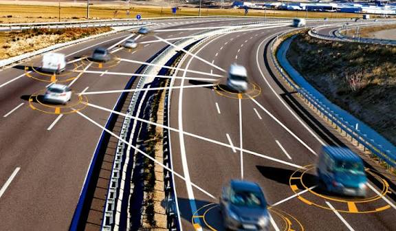
Map and GPS speed limits fall short because they are static databases that do not know what changed on the road today. A speed control system relying on them acts on old information.
The gaps are practical ones. A map does not know a work zone dropped the limit this morning, or that a variable sign lowered it because of ice or heavy rain. GPS can also drift or lose signal in tunnels and urban canyons, so even the position the limit is matched to may be wrong. The result is a speed control system that enforces yesterday’s limit, not the one actually posted right now.
How V2I Delivers the Right Speed Limit
V2I delivers the right limit by letting the vehicle receive it directly from roadside infrastructure in real time. Instead of guessing from a database, the vehicle is told the current limit by the road.
V2I is the wireless exchange of data between vehicles and roadside infrastructure such as traffic signals, sensors, and signs. Roadside units broadcast the current speed limit, work-zone changes, and hazard warnings to approaching vehicles, and variable message signs communicate dynamic limits as they change. Because this data reflects current conditions rather than a fixed record, the speed the vehicle acts on matches the speed the road is posting at that moment.
The V2I Messages That Improve Accuracy
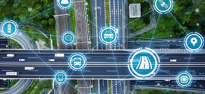
V2I improves accuracy through a few standard message types that carry live road information. Each one feeds the speed control system something a map cannot.
- Dynamic speed limits: roadside units and variable signs broadcast the limit in force right now, including temporary work-zone reductions.
- SPaT (Signal Phase and Timing): traffic signals broadcast their current phase and the time left on it, so a vehicle knows when a light will change.
- MAP messages: detailed road and lane geometry, so the vehicle places itself correctly against the right limit.
- Hazard and weather alerts: infrastructure sensors detect ice, rain, or obstructions and broadcast an immediate warning.
GLOSA: Speed Advice Tied to the Signal
GLOSA, or Green Light Optimal Speed Advisory, is V2I telling a vehicle the speed to hold to reach the next green light. It is the clearest example of infrastructure data driving speed.
Using SPaT data from the signal, a V2I-equipped vehicle calculates the optimal speed to arrive during a green phase, which cuts unnecessary stops and fuel use and smooths traffic flow. For a fleet, this means speed guidance that is tied to the live state of the road ahead, not just a posted number, so vehicles move more efficiently and predictably through signals.
How It Sharpens Speed Control
V2I sharpens speed control by feeding the system a limit that is current, located, and condition-aware. This raises accuracy on three fronts at once.
The limit is current because it comes from the road as it changes, so a work-zone reduction takes effect immediately. It is located correctly because MAP data and roadside broadcasts tie the limit to the exact stretch of road, reducing the GPS errors that misplace a limit.
And it is condition-aware, because weather and hazard alerts let the system lower speed for ice or an obstruction that no map would show. Combined with an intelligent speed adaptation and speed control system, V2I turns a best-guess limit into a verified one.
DSRC vs C-V2X
V2I runs over one of two radio technologies: DSRC or C-V2X. Both carry the same messages; they differ in how they transmit.
DSRC is the established dedicated short-range technology with a long deployment history. C-V2X is the newer cellular-based standard that uses modern mobile networks and offers higher bandwidth and lower latency, which matters for time-critical speed and safety messages. A fleet planning V2I should match its hardware to whichever standard its operating regions are rolling out.
What Fleets Gain
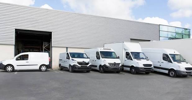
Fleets gain more accurate speed compliance, smoother driving, and better safety from V2I-fed speed control. The value follows directly from acting on correct limits.
Accurate, current limits mean vehicles comply with the real posted speed, including temporary and variable limits, which supports both safety and regulatory records. Signal-aware guidance like GLOSA reduces harsh stops and saves fuel. And condition alerts let vehicles slow for hazards before a driver would see them. Together these make a fleet safer and more efficient, grounded in what the road is actually saying.
Getting Started
A fleet starts by checking regional V2I coverage, fitting compatible hardware, and integrating the data into speed control. Beginning where infrastructure already exists gives the fastest benefit.
- Check where V2I is deployed across the fleet’s routes and which standard is used.
- Fit compatible V2I hardware matched to that standard.
- Feed V2I data into the speed control system so it acts on live limits.
- Combine with GPS and map data as a fallback where infrastructure is absent.
Frequently Asked Questions
What is V2I communication?
V2I is the wireless exchange of data between vehicles and roadside infrastructure such as signals, sensors, and signs. It lets a vehicle receive live information, including current speed limits and hazards, directly from the road. This is more accurate than static map or GPS data.
How does V2I improve speed control accuracy?
V2I improves accuracy by giving the speed control system the limit in force right now, tied to the exact road. It reflects work zones, variable limits, and weather that maps miss. This replaces a best-guess limit with a verified one.
What is GLOSA?
GLOSA, Green Light Optimal Speed Advisory, is a V2I application that tells a vehicle the speed to hold to reach the next green light. It uses live signal timing data to reduce stops and save fuel. It ties speed guidance to the real state of the road ahead.
What is the difference between DSRC and C-V2X?
DSRC is the established short-range V2I radio technology, while C-V2X is the newer cellular-based standard. C-V2X offers higher bandwidth and lower latency using modern mobile networks. Both carry the same V2I messages, so the choice depends on regional deployment.
Why is infrastructure data better than GPS for speed limits?
Infrastructure data is better because it reflects current conditions, not a static database. Roadside sources broadcast temporary work-zone limits, variable limits, and weather changes that GPS and maps cannot capture. This keeps the speed limit the vehicle acts on accurate and up to date.